You're currently viewing the old version of this site.
Please visit www.nakedkayaker.com for recent posts and better maps, etc.!
Showing posts with label cliffs. Show all posts

02 August 2014

Day 15: Bismarck, Baggage, Bayfield, and Bud Light Lime

Early morning #5 billion. After a near miscommunication mishap with the Bismarck baggage agents, I successfully picked up (stole? it was so easy...) Jeff’s luggage before heading east to Fargo. We arrived within a few minutes of each other and booked it across the state of Minnesota in an attempt to arrive at the kayak shop by 4pm. 9 hours later, we arrived at Living Adventures Inc kayak rentals in time to pick up Pierre, the yellow Canadian Current Designs Storm. In Bayfield, we grocery shopped and discovered that Wisconsinites don't eat hummus or pitas (disaster!!!). Walking back to the car, we commented on the intense humidity to which neither of us is accustomed. We went for a 2 hour evening paddle, launching from the Apostle Islands Harbor and paddling south along the peninsula to Pikes Bay. The sandstone cliffs here are nearly vertical and bright red.


At Pikes Bay we found a breakwater constructed out of old train cars filled with boulders. Over time, they have filled in with sand, fostering a community of small birch trees. We floated in a small meadow of stiff green grasses before heading back to Bayfield. 

Breakwater made of old train cars filled with boulders

Back at the marina, we made a delicious spaghetti veggie dinner. I decided to pour half of my bowl on the parking lot... 5-second rule! Jeff enjoyed (?) his first Bud Light Lime. 
Cooking spaghetti and veggies at the Apostle Islands Marina

We’re currently camping in a yard in Washburn owned by my friend John’s cousins. They live in a beautiful house in the woods with a couple dogs and cats. We only chatted with Mike briefly since we arrived rather late, but it’s super nice here. If only I had fixed the marmot-hole in my tent, through-which mosquitos like to flock!

Date: August 2nd, 2014
Distance: 6 miles
Time: 2 hrs


05 May 2013

Muir Beach to Rodeo Beach and then some.

I've been a bit scarce over the past six months thanks to a lovely series of exams to become a professional engineer (fingers crossed!). Even before the exams were over, Alice (new paddling friend in the Bay) and I were scheming to do a coastal paddle from Muir Beach to Rodeo Beach (just north of the Golden Gate). Even though we've both done a bit of coastal paddling, we were a bit nervous to head out by ourselves. Alice posted her first trip to the BASK (Bay Area Sea Kayakers) list-serve, and five other expert BASK paddlers joined us (Gordon, Don, Joe, Bert, and Ross). Gordon offered to carpool with me since we were both coming from the East Bay, so I had the exciting experience of getting a ride in his old sand-yellow mercedes station wagon!

Where Redwood Creek meets the ocean. The Creek is currently undergoing a restoration project to restore some of its natural pathways and habitats after years of farming/development.
The path to the ocean is a bit long, but we shared some wheels and hands to transport boats along the sandy trail to the beach. We gathered on the beach for Alice's first safety talk. We felt safe:

From Joe (arms wide open) clockwise: Don, Ross, Nena (me), Gordon, Alice, and Bert on the camera.  Photo by Bert V!
Even though conditions warned of a small craft advisory, the expert BASKers had never experienced a calmer day on the water at Muir Beach. We launched through a little surf and headed south along the rocky coast. We paddled rocks, the swell lifting us up and down between steep spires on either side.  I mostly avoided the narrow spaces, but a few of us did a bit more rock gardening.

Photo by Bert V.
Three miles down we reached Rodeo Beach. The northern end of the beach is known for dumpy waves that make landing tricky. Even though conditions were calm, we decided to have lunch on the south end.

Lunch spot on Rodeo Beach. Photo by Joe P.
After lunch we headed back north towards Muir Beach. At the rocky point just before Muir Beach most of the group chose to paddle close to the point between the rocks. I chose to paddle out and around, which turned out to be a bit bumpier than I expected. The waves were pretty "confused," coming from two different directions and yanking my boat side to side. Thanks to some quick braces I didn't have to practice my roll, but it was certainly exciting!

There are some fantastic arches and caves along this route. Photo by Joe P.

We passed Muir Beach and continued north "just to the next rock" three times :). When we returned to Muir Beach it was completely transformed - covered in people enjoying the sunny day. We were dodging babies to land on the beach, and had quite the reception. "Where did you come from?" asked the kids with wide eyes, as they scrambled into our boats. I guess we do look like aliens in all our gear...

At the end of the day Alice, Gordon, Ross, and I stopped by the Pelican Inn to enjoy some drinks in the sunny lawn.

Obligatory post-trip Muir Beach factoids
[I should really start doing this before I go on trips]:
  • Muir Beach lies in the Marin Headlands on the Pacific Coast of Marin County (ok, I knew that). 
  • Before Europeans arrived, the area was a wild and dramatic landscape, with bears, bald eagles, mountain lions, bobcats, elk, and many Coast Miwok people who moved from village-to-village.
  • The Portuguese began arriving on whaling ships in the 1850s from the Azores to start dairy ranches. The beach and entire hillside was (apparently) purchased for $10 by a Portuguese settler who built a hotel and some cabins. (How big is a $10 gold coin in the 1850s?)
  • The Old Tavern on the beach used to be a dance hall and host "psychedelic bands," until it was removed in the 1960s and the beach was acquired by CA State Parks. A few members on our trip remembered this Tavern fondly.
See you again soon, Ocean.

Approximate route (Muir Beach at the red marker, Rodeo Beach at the south end of the red line):


Date: Sunday, April 28, 2013
Time: 5 hours
Distance: ~10 miles

07 November 2010

Majestic Clay Cliffs at Chimney Bluffs State Park

The tired wipers pushed aside the sleet clumps and rain drops landing on my windshield. My toasty seat heater made it hard to believe the thermometer that bounced between 35 and 39 degrees as I made the two hour trip north from Ithaca to Sodus Bay.

The plan was to meet the rest of the Surf Rangers at a launch site just east of Chimney Bluffs State Park at 10am. We shivered as we pulled on our extra warm kayaking gear. As the only one without a dry suit, I was lucky that Dennis had an extra one. Although it was meant for surfing and looked goofy next to the kayaker-specific dry suits, it fit well and kept me quite warm!


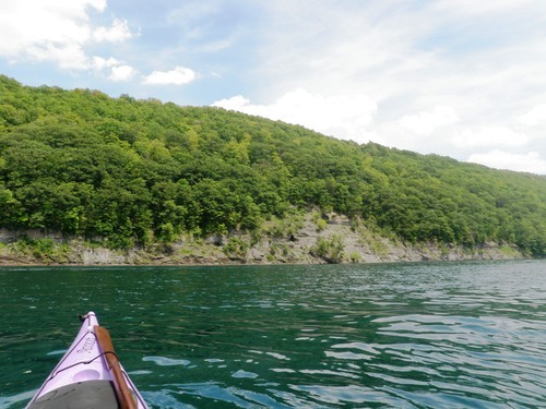
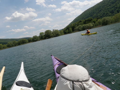
The eight of us (Dave, Morgan, Jeff Berry, Jeff Houck, Heather, Sue, Dennis, and I) launched into Lake Ontario around 11am. The waves were about 3 ft high - enough to make it interesting, but not enough to make it nerve-wracking since all the paddlers present are very comfortable in medium surf conditions.


We paddled about a mile east, around the point and towards the entrance to East Bay. Last year when we paddled the same route the point created some interesting interference patterns - with the 6- 7ft waves breaking farther from shore. It was much calmer this time around.

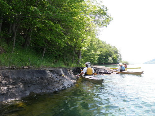
The entrance to East bay was mostly closed (it gets filled in at the end of the season every year), so we beached and portaged over to the bay-side. Here's a picture of Sue and Morgan coming into shore in the surf. This is seconds before Sue (who almost never capsizes) flipped over as she was trying to keep from running into Morgan...


The wind was much calmer on the bay. We paddled as far as possible through the wetlands - until we reached a bridge blocked off by a beaver dam. At this point we stopped to warm up and have some lunch. It was still drizzling slightly, so some of us huddled under Dave's emergency igloo and snacked on Morgan's delicious cookies to stay warm!


On our way out of the bay we decided to try and shoot through the small opening in the wall. A quick turn into the surf and we were all safe and bobbing out on lake again. The paddle back was enjoyable - it was warming up slightly and the rain had stopped.

We continued past our launch site to check out the Bluffs from our boats. Chimney Bluffs is a set of jagged clay cliffs lying on Lake Ontario's southern shore. Over time, rain, wind, and waves have eroded a glacial drumlin (see Wikipedia for a good description) to form the cliffs. As time goes on, they get smaller and smaller.


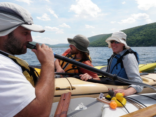
In true Rough-Rider style, we finished our paddle with some fun group pictures:


Once we were all dry, changed, and packed-up, we headed up the trail to check out the cliffs from the rim trail. By this time the sky was clearing up and the sun was shining on the cliffs, making for some very majestic views.


We walked back along the beach. The pebbles on the beach have been polished and rounded over thousands of years, resulting in a very beautiful mixture of colored stones. Dave and I had a strange urge to sort the beach into different colors...


We all headed to a Heather-recommended Mexican restaurant (El Rincon Mexicano) in Sodus for dinner. The food was spicy but delicious. Jeff, whose specialty is Salsa dancing, taught some of us to dance Salsa! This also happened to be the day the restaurant was celebrating El Dia de los Muertos, so we were entertained by a bunch of dancing children!


After a fun-filled day of wintery kayaking, I decided to invest in a pair of paddling gloves and pogies. With these and the dry suit that Dennis is letting me borrow, I will continue paddling into the winter. I won't let kayaking season end!

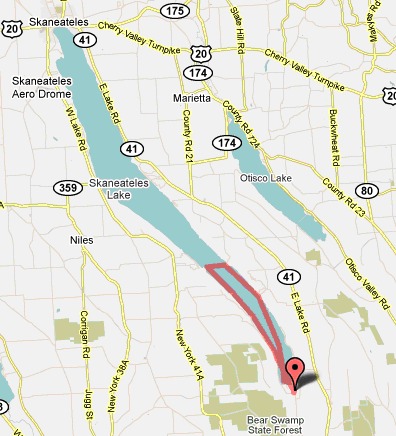
Date: November 6th, 2010
Distance: 8 miles
Weather: 37 degrees, a bit drizzly, a bit sunny


05 June 2010

Memorial Day on Skaneateles

We put in around 8:30am at the south end of the lake at Scott Park. During the short paddle down the inlet, we were welcomed by the fumes of burning garbage, but luckily that passed once we got to the lake.

Skaneateles is known for its steep cliffs and crystal-clear blue-green water. I must say, it complemented my purple boat quite well! The houses along the lake are hidden fairly well, so paddling here feels more secluded and ‘nature-y’.

image

We could see fish swimming more than 10 feet below our boats. I took this picture underwater:

image

It was a scorching hot day, so we spent a great deal of time playing around in the water. Ben helped me and Rob work on balanced braces and hand rolls. We found some flat rocks along a steep bank of the lake without houses on it where we stopped for lunch and went for a *short* dip:

image

Here are a couple pictures from our general shenanigans. We made music with our boats and random words.

image

Then Rob towed us back the last 1/2 mile because we felt he need to be woken up after eating too many peanut butter m&ms.

image

Date: Monday May 31st, 2010


Distance:
12.3 miles

image

That completes approximately 97 miles in a month (which is very close to 100).

All that’s left to the east of Cayuga is Otisco! To the west we still have Conesus, Hemlock, Canadice, Honeoye, and Canadaigua. Sadly, they’ll have to wait until the fall. Until then, stay posted for kayak adventures in New Hampshire!