What's more important that being a good teaching assistant? How about a master's of engineering project? A full load of classes? My job?
That's right... kayaking!
My mother has graciously agreed to pay tuition for Ontario Greenland Camp as my birthday present this year. This is super exciting because I haven't really had a chance (other than a couple random pool sessions) to improve my Greenland paddling/rolling skills since sophomore year when I went down to Georgia for BCU Week, where Cheri Perry & Turner Wilson were holding seminars.
It's the first time they're holding this 3-day camp in September (10 -12th), so I'm not really sure what to expect, but hopefully I'll finally master a forward finishing roll! I was able to do it last time they taught me in one of those tiny Greenland kayaks, but promptly lost it.
And this time, I'll make sure my camera is charged!
25 June 2010
23 June 2010
Wandering around South Uncanoonuc Mountain


20 June 2010
Adventures with Julia and Thundery Kayaking
Warning: This post is too long and I know it... I promise I'll try and keep it more concise from now on!
This weekend I met up with the lovely Julia Schoen in Portsmouth, NH for a weekend of sunny beaches and other adventures. But since this is a kayaking blog, I will cover that part first!
After Julia and I sadly parted ways (she's off to Brazil for a year), I was due to meet up with some kayakers from the NH AMC paddlers group at Odiorne Point State Park in Rye, NH. There were 5 of us in total. The tide (! that scary thing that doesn't exist where I come from) was really low when we put in, so the banks of the shore were SUPER muddy and I almost lost my chacos getting in. Normally I try to keep my feet dry when I'm getting in my boat (call me a wimp), but there really was no getting around it this time (and of course I couldn't seem like a wimp around these new peeps!).
Date: 6/20/10
Distance: ~4 miles

As we were first heading out, we heard some rumbling in the distance, but the trip leaders said it was from a nearby bridge. It was definitely thunder. But as usual, I figured these NH'ers knew what they were doing and followed blindly (do you see a theme? if not, read the previous post). We paddled along the beaches at the park and then cut across to circumnavigate Leachs Island. On the way over there we had to pass under a bridge that kind of constricted the water, and since the tide was coming back in we were flushed right through. As I was being rushed towards the bridge, it occurred to me that a couple of the bridge supports were closer together than the length of a sea kayak, and definitely would have made for some good strainers. I only realized this at the last moment and had to resort to a hasty yet somewhat effective side slip. Woohoo!
The way back through the bridge was a lot harder because the flow rate had increased and the downstream water was churning in all kinds of directions. I hopped in an eddy before ferrying across and paddling as hard as I could upstream to get back to the other side (COE whitewater class is highly recommended!) .
Once we were on the other side of the bridge the rain started coming down and the thunder picked up again. I was not so cool with that, and the end was in sight, so I paddled in as fast as possible. Just as I got my boat up onto my car there was a HUGE crack of thunder directly over our heads. I probably jumped 1.5 feet into the air and decided to make the trip home in my wet clothes. For some reason everyone else seemed less phased than me... maybe I should add thunderstorms to my list of fears (right after spiders), or maybe I just have a very conservative attitude towards kayaking in thunderstorms.
ANYWAYS, I made it home alive, only slightly dusted with dried salt water and frizzy hair. I miss my Rochester and Ithaca paddling buddies!
This is the part where you stop reading if you just care about kayaking (perfectly valid).
Rewinding now to Friday night. Julia and I both pulled into the parking lot of Shel-Al Campground (we think it's a contraction of the superbly sweet owners' names) exactly 2 hours later than planned. I managed to leave my tent in the backyard and only realize once I was halfway to the coast, and she locked her keys in the car and printed out the wrong directions. It worked out quite well!
There really aren't many places to camp along the NH coast (correct me if I'm wrong). Shel-Al was the only one within a reasonable driving distance of the coast, and it's mainly focused on trailers. But it worked out quite nicely since there were very few tent-ers there this weekend.
Both Friday and Saturday night we went into Portsmouth and explored. It's a really lovely city with a bunch of streets with *local* restaurants and shops. I'd love to return when my mother is in a shopping mood (is that terrible of me?). After making a stop on Newcastle Island (just had to do it. brown ale is just too good), we had dinner downtown at a little seafood restaurant with a very friendly waitress. After dinner we sat on a big rock by the ocean and listened to the waves.
On Newcastle Island:

On Saturday we drove up and down the coast (Route 1A, Ocean Blvd) multiple times, testing out Odiorne Point, Rye, Jenness, Hampton Beach. Julia made me get in the water, which was good because I'm a chicken when it comes to these (icy cold) things... While in search of a surf shop we discovered a delicious little cafe on 7th street in Hampton called KB Bagels. Highly recommended.

Saturday night we cooked couscous and black beans for dinner, and I took an ice-cold shower to dampen the terrible sunburn I managed to acquire. Around dusk we decided to make some hot drinks and the mosquitoes decided to join us. They came out in droves and we fled to the safety of the Volvo. We put the seats back, sipped our hot cocoa with Bailey's, listened to Jack Johnson, and watched our classy neighbors setting off fireworks (just for us of course). Magical.
The next morning we woke up to the 4am alarm and dragged ourselves back to the coast to watch the sunrise (5:03am). At first we were worried that it would hide behind the clouds, but around 5:30am it revealed it's cheery face. It was quite a relief since Julia would have hated me forever if it hadn't.

After another trip to KB's for some much needed coffee and a frigid swim (by Julia), we parted ways. Now you can scroll back to the top and start over! (This is the post that never ends... and it goes on and on....... sorry.)
Putting my legs to good use! (Mt. Lafayette and Mt. Jackson)
So this may become my outdoor adventures blog since there are lots of other fun things to do in NH! Like climb mountains!
Last weekend (6/12 - 6/13) I joined some people (Dave, Peter, Julie, Simon, and Travis) from DEKA (where I'm doing my internship) on a one night camping/hiking trip in the White Mountains. The drive up to our campground (Lafayette Campground in Franconia Notch) took about 1.5 hrs. We claimed our turf and promptly walked to the trailhead across the road to being our trek up Mt. Lafayette. There were thunderstorms in the forecast, due to arrive at 2pm. Exactly when we planned to reach the summit. They seemed cool with that... so I put my life in their hands.
Lots of people here are into hiking the 48 peaks above 4000 ft in the Whites, so the two mountains we climbed were both on the list. 46 to go! (ha.)
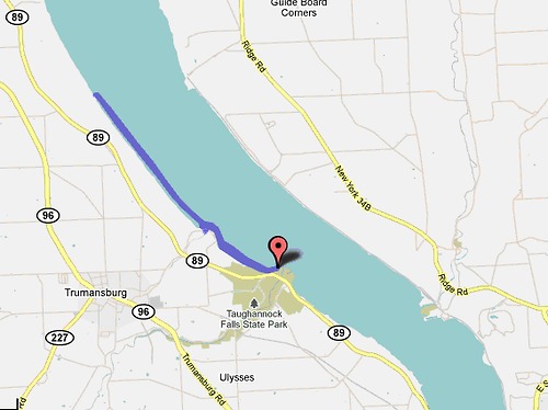
Below are the trail maps for the two hikes we did (Mt. Lafayette on Saturday and Mt. Jackson on Sunday). For Mt. Lafayette we took Old Bridle Path to Greenleaf Hut and Greenleaf Trail to the summit. We came back down the same way since it was raining and Falling Waters Trail would not have been fun (as the name suggests). 8 miles total.

The top was completely above treeline, which was a really neat (and exhausting) experience. Unfortunately we were completely covered in clouds. Every once in a while a breeze would blow the clouds away and allow a view, but mostly it looked like this:

The next day we met up with Jed and took the Webster-Jackson Trail up to Mt. Jackson, where we were very excited to have a beautiful view! Then we cut over to the Mizpah hut and headed back that way.
 Feeling small on the top. One of my favorite feelings :)

On the way home we stopped in North Conway to check out some gear shops that have consignment sections where people sell their used gear at a good price. I bought my first backpacking pack (Osprey)! We had dinner at Moat Mountain Smokehouse - a place that the Deka guys were super excited about (for a good reason!).
All in all a great weekend: beautiful mountains, fun bunch of people, amazing food, and a pair of very sore legs to remind me for the next three days!
Last weekend (6/12 - 6/13) I joined some people (Dave, Peter, Julie, Simon, and Travis) from DEKA (where I'm doing my internship) on a one night camping/hiking trip in the White Mountains. The drive up to our campground (Lafayette Campground in Franconia Notch) took about 1.5 hrs. We claimed our turf and promptly walked to the trailhead across the road to being our trek up Mt. Lafayette. There were thunderstorms in the forecast, due to arrive at 2pm. Exactly when we planned to reach the summit. They seemed cool with that... so I put my life in their hands.
Lots of people here are into hiking the 48 peaks above 4000 ft in the Whites, so the two mountains we climbed were both on the list. 46 to go! (ha.)
Below are the trail maps for the two hikes we did (Mt. Lafayette on Saturday and Mt. Jackson on Sunday). For Mt. Lafayette we took Old Bridle Path to Greenleaf Hut and Greenleaf Trail to the summit. We came back down the same way since it was raining and Falling Waters Trail would not have been fun (as the name suggests). 8 miles total.

The top was completely above treeline, which was a really neat (and exhausting) experience. Unfortunately we were completely covered in clouds. Every once in a while a breeze would blow the clouds away and allow a view, but mostly it looked like this:

The next day we met up with Jed and took the Webster-Jackson Trail up to Mt. Jackson, where we were very excited to have a beautiful view! Then we cut over to the Mizpah hut and headed back that way.


On the way home we stopped in North Conway to check out some gear shops that have consignment sections where people sell their used gear at a good price. I bought my first backpacking pack (Osprey)! We had dinner at Moat Mountain Smokehouse - a place that the Deka guys were super excited about (for a good reason!).
All in all a great weekend: beautiful mountains, fun bunch of people, amazing food, and a pair of very sore legs to remind me for the next three days!
05 June 2010
Exploring Honeoye ... er... Conesus!
When we (Neal, a new rough rider, and I) arrived at Honeoye Lake, we couldn’t seem to find the park to launch from so we stopped at a gas station to ask for directions. As we pulled into the gas station I finally decided it would be a good idea to pull out my map of NY to see where exactly we were. Somehow we’d managed to miss Honeoye and end up at Conesus (3 lakes over! oops). No worries! Conesus is still a finger lake, so we put in at a little park off of Pebble Beach Rd and started paddling!
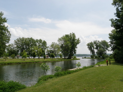
A picture of the put-in:
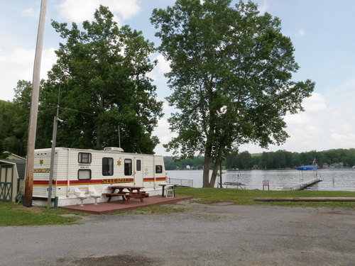
A few miles down we stopped at a park that had a designated swimming area and two docks (one for the awesome sheriff’s trailer that was stationed there):
So far, Conesus is probably the most (consistently) built-up finger lake. All the other lakes have at least short stretches of shore that are either too steep to hold houses, or the houses are well camouflaged in the trees.
At the turning point we stopped to cool off and try standing up in our boats. Needless to say, we got quite damp.
Then Neal wanted to try a roll (which he’d only really read about and tried once or twice). I demonstrated a sweep roll. He tried it and made it up on the first (and second and third) try. Considering that it took me 2 years to really learn how to roll, I was quite surprised. Pretty exciting!
We crossed the lake and headed up the east side, making it back to the put-in about 4 hours after we left.
This trip puts me at 109 miles before leaving for NH!
Date: Friday June 4th, 2010
Distance: 12.5 miles
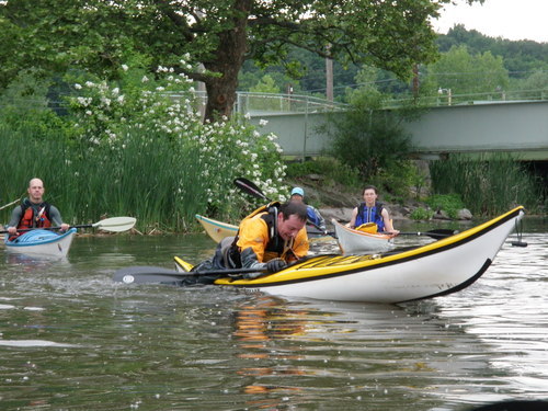
Rough Rider Rescues (Year 4!)
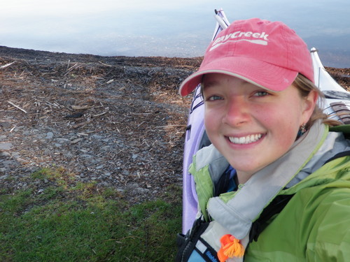
Every year, the first Rough Riders session is a rescue class to make sure everyone is up to date on their deep water re-entries. This Thursday, 26 Rough Riders met up at BayCreek and worked on paddle float, rodeo, and assisted (T-X) re-entries. It was a splashing good time!
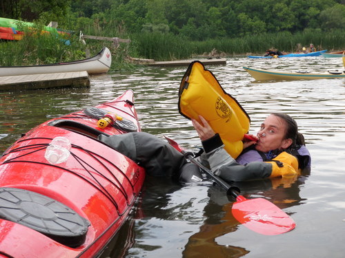
Jess filling up her paddle float:
Mike demonstrating the rodeo re-entry.
Post paddling we headed over to MacGreggor’s.
Date: June 3rd, 2010
Distance: negligible
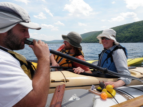
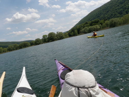
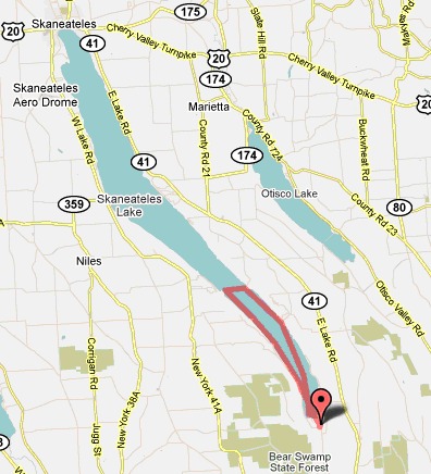
Memorial Day on Skaneateles
We put in around 8:30am at the south end of the lake at Scott Park. During the short paddle down the inlet, we were welcomed by the fumes of burning garbage, but luckily that passed once we got to the lake.
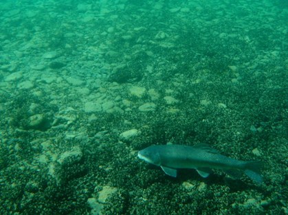
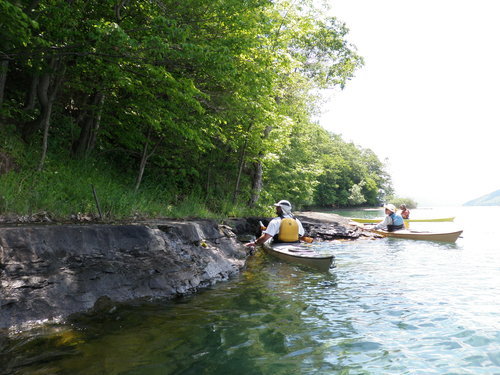
Skaneateles is known for its steep cliffs and crystal-clear blue-green water. I must say, it complemented my purple boat quite well! The houses along the lake are hidden fairly well, so paddling here feels more secluded and ‘nature-y’.
We could see fish swimming more than 10 feet below our boats. I took this picture underwater:
It was a scorching hot day, so we spent a great deal of time playing around in the water. Ben helped me and Rob work on balanced braces and hand rolls. We found some flat rocks along a steep bank of the lake without houses on it where we stopped for lunch and went for a *short* dip:
Here are a couple pictures from our general shenanigans. We made music with our boats and random words.
Then Rob towed us back the last 1/2 mile because we felt he need to be woken up after eating too many peanut butter m&ms.
Date: Monday May 31st, 2010
Distance: 12.3 miles
That completes approximately 97 miles in a month (which is very close to 100).
All that’s left to the east of Cayuga is Otisco! To the west we still have Conesus, Hemlock, Canadice, Honeoye, and Canadaigua. Sadly, they’ll have to wait until the fall. Until then, stay posted for kayak adventures in New Hampshire!
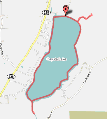
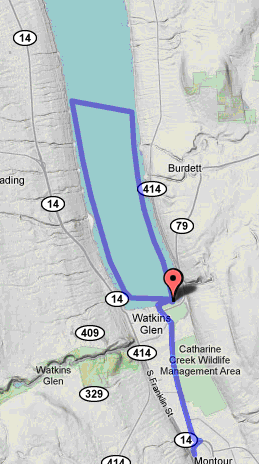
Circumnavigating Cayuta by Canoe
It’s a cute little lake located about ten miles southeast of Watkins Glen. It's named after the Senecan Princess Kayutah, whose mother filled the lake with tears after her daughter was kidnapped. The east and west shores are lined with houses and trailers. The put-in is at the north end.
We canoed around the lake, stopping to check out the inlet and outlet at the north and south ends of the lake, respectively. We saw some big beaver dams (one completely blocked off the outlet channel). The ferns looked really pretty in the evening sun. I would show you a picture, but I decided it would be a good idea to set my camera on the back of my car before driving away along the bumpy dirt road.
oh well. maybe it will turn up.
Thunderstorms were in the forecast, so it was quite exciting when the wind picked up and the temperature dropped just as we reached the far end of the lake.
Date: Thursday May 28th, 2010
Distance: 4.5 miles
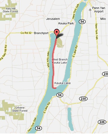
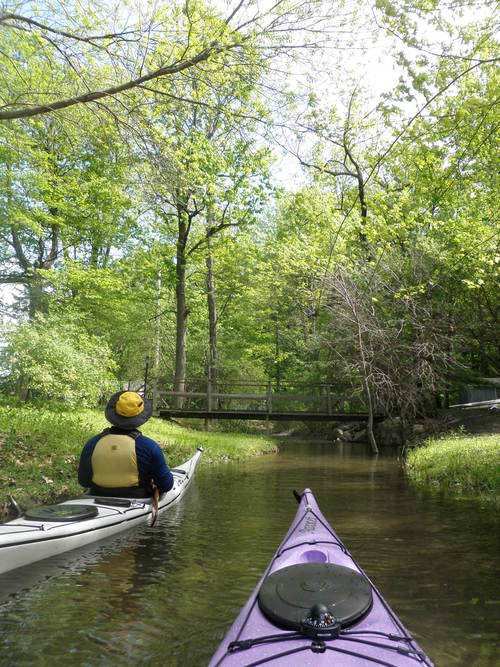
Keuka Lake is Shaped Like a Y
Since it is such an interesting shape, we were determined to see all three ‘arms’ of the lake. The problem with this is that there are only a few public launches on the lake - all of which are at the two northern tips. We decided to paddle from the shorter of the two arms to the intersection to make sure we could check out the whole lake.
Ben making dinner plans with Rob (on a cell phone in a kayak…):
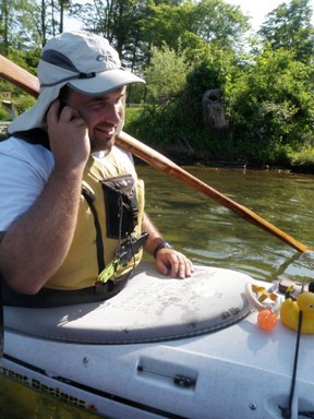
At first paddling felt really hard (we got up at 6am and had a 1.5 hour drive to get to the launch), but after a couple rolls in the frigid (yet still warmer than Cayuga) water, we were awake and energized!
We made good progress paddling with the wind on the way south. The shores of Keuka felt much less industrialized than Seneca (two salt mines) and Cayuga (power plant), which was a nice change. There are fewer developed areas on the hilltops too. The cottonwood trees shedding in the early morning light coated the surface of the water in a thin layer of fluffy snow (wish I’d taken a picture!).
Paddling with the Y-intersection in site (woops, some water droplets on the lens):
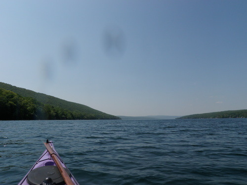
We had lunch on a little stony beach (which probably wasn’t public, but was at least hidden from view). The sun was really strong, and even with multiple coats of sunscreen and a baseball cap I still burned my ears and arms! I have also been informed that I now have a redneck tan line. Awesome.
Date: Thursday, May 27th, 2010
Distance: 13 miles
Skaneateles Lake, here we come!
Ben making dinner plans with Rob (on a cell phone in a kayak…):
At first paddling felt really hard (we got up at 6am and had a 1.5 hour drive to get to the launch), but after a couple rolls in the frigid (yet still warmer than Cayuga) water, we were awake and energized!
We made good progress paddling with the wind on the way south. The shores of Keuka felt much less industrialized than Seneca (two salt mines) and Cayuga (power plant), which was a nice change. There are fewer developed areas on the hilltops too. The cottonwood trees shedding in the early morning light coated the surface of the water in a thin layer of fluffy snow (wish I’d taken a picture!).
Paddling with the Y-intersection in site (woops, some water droplets on the lens):
We had lunch on a little stony beach (which probably wasn’t public, but was at least hidden from view). The sun was really strong, and even with multiple coats of sunscreen and a baseball cap I still burned my ears and arms! I have also been informed that I now have a redneck tan line. Awesome.
Date: Thursday, May 27th, 2010
Distance: 13 miles
Skaneateles Lake, here we come!
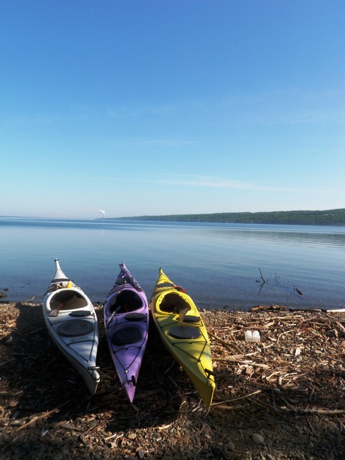
Sunset on Northern Cayuga
We put in at Long Point State Park (unfortunately they charge a $7/vehicle entrance fee) near Aurora, NY (on the east side of Cayuga). We all managed to forget our “snackies,” so we decided to pull over after a couple miles to find a cafe. After some effort, we found a really nice spot with a dock (we’re pretty sure it was public…) where we hopped out of our boats and went searching for the cafe (2/3 of us in our sprayskirts, 1/3 of us in our underwear). After some soup, sandwiches, coffee and Shirley Temples, we were back in our boats and headed north.
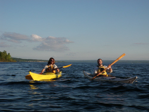
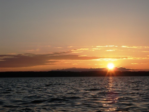
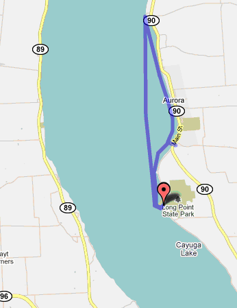
On the way back the wind picked up and we had quite the workout, but the gorgeous sunset made up for it.
Date: Sunday, May 23rd 2010
Distance: 10 miles
Exploring North of Taughannock
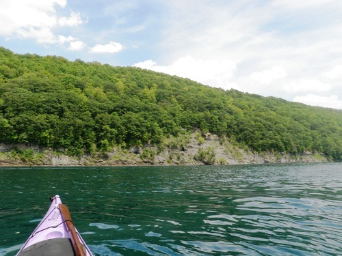
After getting a serious case of “kayaker’s high” from the gorgeous paddle the night before, we decided to meet up at 8am at Taughannock State Park to squeeze in another morning paddle. We put in on the north shore of the park.
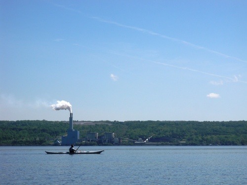
We paddled past Camp Barton (a boy scout camp) and kept going north until we were directly across from Milliken Station (Ithaca’s power plant):
We have also gotten into the habit of making bets for how long it will take us to reach certain points. On this particular day we had a very close race with Ben’s guess of 24 min, 38 sec coming within 38 seconds of the actual time. Rob and I now owe him a beer. But he owes me one for the last time, so I guess that means we’re even.
The cliffs on the west side of Cayuga are pretty neat to look at. There are big boulders in the (incredibly clear) water and little waterfalls that trickle down over the rocks from the hills above. Right before getting back to Taughannock we were paddling along and suddenly had a really strange feeling that we were paddling uphill. We think it’s because the water is so clear and the bottom slope of the lake was really steep (getting shallower as we got closer to the beach) — so it was some kind of optical illusion. Weird but cool…
 Date: Monday, May 24th, 2010.
Distance: 10 miles.
We paddled past Camp Barton (a boy scout camp) and kept going north until we were directly across from Milliken Station (Ithaca’s power plant):
We have also gotten into the habit of making bets for how long it will take us to reach certain points. On this particular day we had a very close race with Ben’s guess of 24 min, 38 sec coming within 38 seconds of the actual time. Rob and I now owe him a beer. But he owes me one for the last time, so I guess that means we’re even.
The cliffs on the west side of Cayuga are pretty neat to look at. There are big boulders in the (incredibly clear) water and little waterfalls that trickle down over the rocks from the hills above. Right before getting back to Taughannock we were paddling along and suddenly had a really strange feeling that we were paddling uphill. We think it’s because the water is so clear and the bottom slope of the lake was really steep (getting shallower as we got closer to the beach) — so it was some kind of optical illusion. Weird but cool…
Distance: 10 miles.
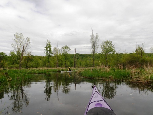
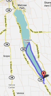
Lower Half of Owasco
Owasco is a fun little lake with lots of nooks and crannies to explore. To get to the put-in at the south end of the lake you drive to Southshore Marina and a little dirt road at the back of the parking lot takes you to a small parking lot at the point where the inlet meets the lake.
A photo of the lake and inlet from the put-in:
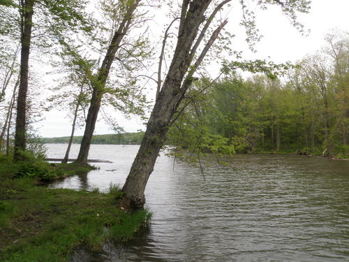
A photo of the lake and inlet from the put-in:
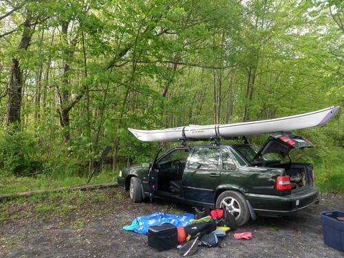
This boxey thing makes it all possible!
The Seneca and Cayuga inlets are really built up (urban kayaking) and kind of gross, but the Owasco inlet begins with a wetlands area (LOTS of birds and other critters) and continues with a wide, serene channel that winds back for many miles into the woods. The cool thing about that is that on a windy day you can explore the inlet instead of the lake! There’s a (somewhat mucky) hiking trail that goes from the put-in back along the channels.
Wetlands area:
Even though it was a bit windy, we decided to try and paddle a section of the lake. We found lots of little creeks to explore along the way:
Date: Wednesday, May 19th, 2010
Distance: 14 miles
Wiz Canoe!
Sometimes I go canoeing too. I thought about adding a “and sometimes canoeist” clause to the title of this blog, but that was just too long.
On May 11th the COE wizards circumnavigated Dryden Lake (a great feat). Here are some photos:
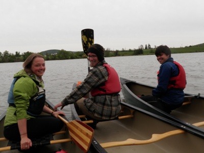
On May 11th the COE wizards circumnavigated Dryden Lake (a great feat). Here are some photos:
Laura, Emily, and Ben in the back.
Me, Devin, and Joe in the front!
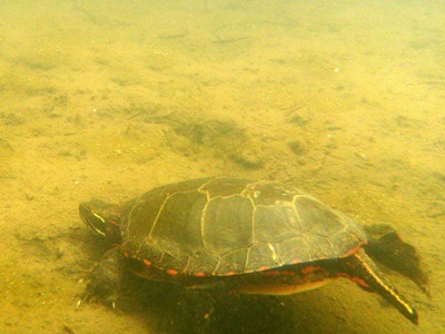
We saw a painted turtle:
After a long and strenuous paddle, we stopped for the worlds best cinnamon rolls at a little bakery in Dryden, NY. Yum!
Expedition to Taughannock
One morning Ben and I decided to make the voyage (is that the aqueous version of ‘trek’?) to Taughannock Park, starting at East Shore Park. We were on the foggy water by about 7:30AM.
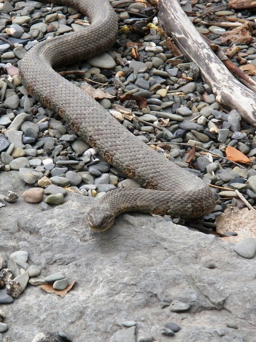
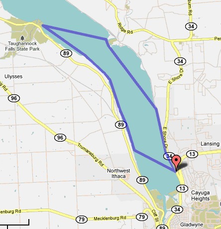
We got to Taughannock Park in time to have a very early lunch. Shortly after lunch I managed to not-so-gracefully fall into the water upon trying to get back into my boat.
When we finally got back to East Shore Park, we found this not-so-little brown water snake:
Date: Thursday, May 13th, 2010
Distance: 15 miles
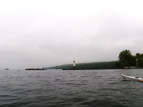
Slope Day on Seneca
Yep, that’s right… I’m super lame and went kayaking on Slope Day instead of seeing… Drake? Who is that?
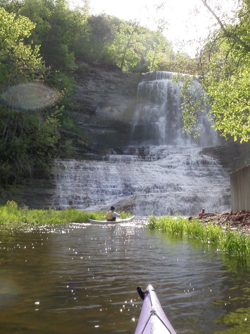
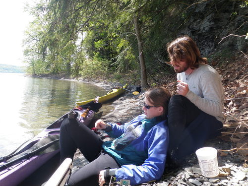
We (Ben, Rob, Anna, and I) met at the southern tip of Seneca Lake and launched from Lakeside Park in Watkins Glen around 7:30AM. This means my alarm was set for 5:30AM… it was painful.
We decided (by “we” I mean Anna, because she is the official decision maker) that since the lake was glassy-calm we would first paddle out in the open and think about exploring the inlet later. So off we went!
Along the way we discovered lots of little waterfalls and creeks that drain into the lake. About 2 miles up the east side of the lake we discovered Hector Falls, which you get to by paddling into a little stream and under a bridge:
We couldn’t find any good beaches along the east side to have lunch so we decided to cross the lake and check out the west side, where we found a thin strip of beach next to some cliffs. It’s kind of tricky to find spots to get out of your boats and stretch your legs in the Finger Lakes since they’re pretty heavily developed…
Rob & Anna chilling by the lake during lunch.
After lunch we paddled back to the cars, stretched, and decided to explore the inlet, which could be classified as urban kayaking. We paddled as far as we could go, which involved ducking under some pretty low bridges. At the end we discovered that the river was running in both directions! This is still a mystery…
Date: Friday May 7th, 2010
Distance: 15 miles
p.s. I paddled the whole way with my greenland paddle. woohoo!
A Short Stint on Cayuga
Date: Sunday, May 2nd
Distance: 7.5 miles (start & end at East Shore Park, sticking to the east side of the lake)
Weather: Calm on the way out, windy on the way back (not in our favor)
Distance: 7.5 miles (start & end at East Shore Park, sticking to the east side of the lake)
Weather: Calm on the way out, windy on the way back (not in our favor)
Cayuga is long… really long. This is not going to be easy!

These first few posts will probably be kind of short since I’m just trying to catch up!
Subscribe to:
Posts (Atom)