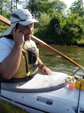
Ben making dinner plans with Rob (on a cell phone in a kayak…):
At first paddling felt really hard (we got up at 6am and had a 1.5 hour drive to get to the launch), but after a couple rolls in the frigid (yet still warmer than Cayuga) water, we were awake and energized!
We made good progress paddling with the wind on the way south. The shores of Keuka felt much less industrialized than Seneca (two salt mines) and Cayuga (power plant), which was a nice change. There are fewer developed areas on the hilltops too. The cottonwood trees shedding in the early morning light coated the surface of the water in a thin layer of fluffy snow (wish I’d taken a picture!).
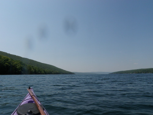
Paddling with the Y-intersection in site (woops, some water droplets on the lens):
We had lunch on a little stony beach (which probably wasn’t public, but was at least hidden from view). The sun was really strong, and even with multiple coats of sunscreen and a baseball cap I still burned my ears and arms! I have also been informed that I now have a redneck tan line. Awesome.
Date: Thursday, May 27th, 2010
Distance: 13 miles
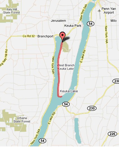
Skaneateles Lake, here we come!
1 comment:
For the record, I've yet to bring a cell phone kayaking. (And the demons will be throwing snowballs before I do...)
This picture is purely a result of Nena's deviousness. That's *her* cell phone which *she* dialed, waited until in was ringing, handed it to me and said, "Here, you talk to Rob." Then she whipped out her camera.
Post a Comment