You're currently viewing the old version of this site.
Please visit www.nakedkayaker.com for recent posts and better maps, etc.!
Showing posts with label kayaking. Show all posts

22 September 2014

Rotte River: 20 km Bike, 20 km Kayak, 20 km Bike

A couple months ago, while searching for Dutch kayaking info, I discovered Johan's Kano Route website, which describes kayaking routes in the Netherlands and a few in other countries. I clicked around for the routes within biking distance of Delft, and there are quite a few. He always lists the nearest kayak rental shops, which is helpful for a car-less boat-less person like me. Elizabeth and I decided to embark on the Rotterdam route (which only takes you to the center of Rotterdam if you paddle > 16 miles).  
 
Greenhouses, canals, and bike paths. So far, that sums up the suburban scenery within biking distance of Delft.
Early Sunday morning we departed the sleepy streets of Delft and biked east, towards Berkel en Rodenrijs - a small town approximately half way to our destination. We were sorely disappointed when every single business was still closed, even the coffee shops, at 9am. The scenery gradually transitioned to more agricultural, and around 10am we arrived at the Rottemeren ("lakes of the Rotte river"), where we rented two little kayaks from Botenverhuur Van Vliet. While we were happy with the affordable rentals (€5/hour or €25/day), we were a bit miffed to hear that PFD rentals were at additional cost, especially when we were given extra large PFDs that contained very little flotation material. I suppose kayaking on highly regulated canals is a bit safer than other settings, but still! The boats were a small step up from the whitewater boats that Stijn, Bridget, and I rented in Ghent a few weeks earlier.

Along the canals you find rowing clubs every few miles!
The rental shop is on the west side of the Rotte River, the namesake of nearby Rotterdam. The river is constrained on either side by high levees - the surrounding areas lie well below sea level. We were surprised by the narrow freeboard (vertical space between water level and top of levee) along much of the river. This may be due to the small watershed area of the Rotte - it originates just a few kilometers north of where we started kayaking.

Historically, the Rotte River drained the Zuidplas Lake, before it was turned into the Zuidplaspolder in 1840. A polder is a low-lying area that used to be marsh/wetland/water and was drained and diked by humans for development. At 7m (24 ft) below sea level, the Zuidplaspolder is tied with the Lammefjorden in Denmark for the lowest ("dry") point in Western Europe. I wish I'd known this before our trip!

Thousands of fundraising bikers passing the Cafe Oud Verlaat
Dark clouds released a 10 minute rainstorm while we changed into our kayaking outfits. Luckily, 5 minutes into the trip the rain stopped and didn't bother us again all day. The first portion of the route goes through the Rottemeren, where the Rotte widens into a gusty lake where sailing is popular. Soon, the river narrowed again. Our motivation level was at a bit of a low, so we landed on the dock at Cafe Oud Verlaat (see photo above) and paused for some hot drinks and typical Dutch apple cake. The cafe was packed with Sunday morning biker groups, who were having the same fare.

So happy to have found coffee and apple cake, 2 miles into our paddle :)
Filled with apple cake energy
Back on the water a half hour later, we were revived and excited to continue on our journey. We passed an artificial ski hill, where people seemed to be skiing and snowboarding (no snow, mind you). At this point the river became more developed, and we had a chance to see into the lives of many canal side families enjoying a relaxed Sunday brunch (no one closes their curtains here). 

Massive canal houses
Can't forget the windmill photo
Crew shells and many large boats sped past us, and we joked about hitching a ride on the way back (well, it was serious until it came down to putting our thumbs out - then my shyness overtook the situation!). We often caught up to the large boats at low bridges, which we zipped under while the larger boats waited for the scheduled bridge openings. 

We paddled until ~1pm, when we looked at the map and realized that downtown Rotterdam and the Kralingse Plas (two potential destinations) were still many kilometers away. Instead, we aimed for the Bergse Voorplas, a lake on the right side of the river. The map showed a narrow blue strip connecting the river to the south end of the lake. To our disappointment (or maybe relief?), the narrow canal was actually a manually-operated lock connecting the high river to the low lake. Instead, we unloaded at a small dock and walked across the levee to the lake with our afternoon veggie snacks. The lake was incredibly windy, so we turned around after a short walk to the marina, where a sailing race was beginning. We watched a small motor boat passing through the lock, which was manually operated by a woman sitting in the adjacent booth. 

Views across the Bergse Voorplas (small lake with many sailboats)
Not too much happened on the return trip, except a gradual draining of our energy levels and increase in wind. We paid for our kayak rentals and made it 0.5 km down the bike path before veering into a lakeside cafe, where we feasted on tomato soup, french fries, croquet (fried gravy stick), and two massive bottles of water, which I promptly poured into my nalgene bottle (much to the server's amusement).

Typical canal scenery
We took a more scenic and slightly longer bike route back to Delft, consisting of mostly independent bike paths (no adjacent street). At ~7pm we arrived home and I promptly fell asleep before I could even taste the delicious deviled eggs that Elizabeth made for dinner. 


Date: Sunday, Sep 21st, 2014
Distance: 12.2 miles (19.6 km) kayaking + 24 miles (39 km) of biking
Duration: 6 hrs kayaking + 2.5 hrs biking (includes 2 cafe stops!)

30 August 2014

Leie River in Ghent, Belgium: from Pastures to Centrum

Blog post by Nena, Bridget’s comments in [italics]. This post is too long... you might want to look at the photos and skip to the part about the canal swim incident. Also, Stijn has some additional photos here!

On Friday morning we awoke to the hamster wheel (a common occurrence in Belgium) at Nonkle Jan’s and Tante Els’s house in Bierbeek (Beertown).  The day prior we had gone for a long walk through the fields and orchards with Els, Ona, and Ides. Ides decided to bike, but the past weeks’ rain had saturated the trails. The back wheel whipped up mud on his shirt, and he spent the next hour whining about doing the laundry (quite a responsible whine for an 11 year old). We passed orchard after orchard of pears and apples, eating a piece of fruit at each until we were nearly sick. Delicious! Two weeks ago, Russia stopped buying pears from the Belgians due to the Ukraine conflict, so the trees were still lush with ripe pears. The Belgian government is trying to convince the citizens to eat a pear-a-day to help the farmers.


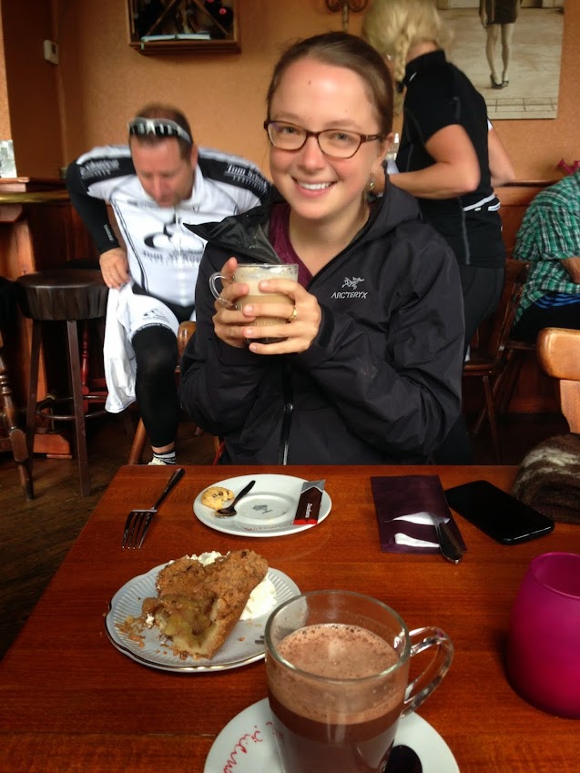
After a huge pasta-veggie dinner, Bridget and I sipped wine while we watched my first Design of Coastal Structures lecture online. [Nena’s aunt cut me off after I missed my mouth while trying to drink sparkling water]. Ok, back to Friday.

Els dropped us off at the Leuven train station, with 30 minutes to spare before our train to Ghent. We cleverly decided to catch the earlier train. We soon realized that this was the local train, which takes approximately twice as long, resulting in a 30-minute late arrival in Ghent. We met my Bay Area kayaking friend, Stijn, who was patiently waiting at the station. Stijn and I are both members of the Bay Area Sea Kayakers and met at Berkeley Kayak Polo. He’s from Belgium and still spends a portion of his time working on art installations here. [He gets paid to design tree houses in Italy.]

With Bridget hidden stealthily in the back of the cargo van [stuffing my face with an Italian sandwich I was supposed to save for lunch], Stijn drove us to a launch site south of the city, in Drongen, where the kayak rental company (PONAS) had parked the trailer near the Leie River. Three yellow river-running white water boats (Taifuns) were perched on the top of the otherwise empty trailer. We waterproofed our cell phones (plastic bags with no ziplock), loaded up a plastic drum that served as a dry box, and launched before a massive group of kids on tiny sit-on-tops had a chance to take over the canal. The white-water flair of these kayaks immediately manifested itself as we struggled to maintain a straight course up the channel [major understatement]. While awesomely purple, our paddles weighed at least 100 lbs and the task ahead was daunting.


There was no obvious flow in the channel. Stijn informed us that it connects a river to another channel, and while it experiences some tidal influence (this surprised me – I had forgotten how close we were to the coast), it was not large enough to notice in our paddling. We headed north, towards the city. Initially, the channel was lined with perfectly manicured lawns [mowed by automatic drone lawnmowers] and well-windowed mansions. Stijn remarked that he felt a twinge of claustrophobia in this overly-developed narrow channel, and we agreed that grassy lawns are terrible things.

Bridget taking her 4th nap of the day, and Stijn stressing about the manicured lawns.
The next stretch was rural, with pastures, corn, and other crops. Every ten minutes a massive yacht passed by, leaving little room for us to fit our boats. Bridget set the tone for the day by placing herself in the middle of the channel every time a massive tour boat or yacht came around the bend [I swear they were trying to hit me]. After a couple pee breaks (Stijn found a scenic grove of trees and Bridget and I chose a highway underpass), we arrived at a sign pointing to Ghent Centrum. We also asked a canal-side pedestrian for directions, but he pointed repeatedly in both directions, resulting in more confusion than assistance.


We soon tired of our overly-responsive kayaks and heavy paddles, happily arriving in Gent Centrum at 1:30pm. Our pace slowed a bit as we stopped to take photos of the churches, bridges [Nena accidentally wrote Bridgets, but I had to correct this], and other scenic architecture. As we approached, the tourist boats multiplied and we found ourselves weaving between crowds of tourists who photographed us rather than the gorgeous old buildings that define the city.  We saw only one other kayaker in a racing boat (with admittedly terrible form). Narrow stone staircases punctuated the rock walls that lead up to the adjacent sidewalks. Since the stairways are inset and are not as wide as our kayaks, it took a bit of maneuvering to get out of the boats [It was not that hard].

Entering Gent Centrum, under Jakobijenstraat 
Stijn explaining something emphatically
Bridget admiring Sint-Niklaaskerk
Disembarking kayaks: a great success!
First order of business: fries and beers. Stijn directed us to a narrow alleyway where Bridget and I found a little “frietkot” (fry shack) while he stayed to watch the kayaks (you’re not really supposed to unload your kayaks in the middle of the city center…). We ordered 3 portions of fries, 3 sauces, and 3 beers, which generated quite the ruckus from the impatient locals behind us.  We spent an hour or so snacking on fries, people watching, and napping (on Bridget’s part, of course).

Little yellow kayaks in front of some of the oldest buildings in Ghent
Pommes frites! Photo by Stijn S.
Next order of business: loosen our PFD straps to accommodate fry/beer-bellies, launch without falling in front of hundreds of curious tourists, and kayak towards the CASTLE. Yes, we kayaked to an ancient castle [and played kayak polo with a green floaty ball that Stijn found in the moat of the castle]. It's called Gravensteen (the Count's Castle), was built in 1180, and later served as a courthouse and prison. There wasn’t too much to be seen, other than Rapunzel’s hair, an overgrown moat, and some Dutch lovers sitting romantically in a grassy patch.

Conquering the castle. Photo by Stijn S.
WiFi in the canal. Onlookers amused/confused/angry? Photo by Stijn S.
We continued on a side channel until we arrived at an all-too-common impasse: the lock. The water level on the other side was significantly lower, and signs warned us from getting too close to the overspill. Exhausted, we turned around and paddled towards the agreed-upon take-out, where the kayak dude was supposed to meet us an hour later. Stijn’s friend’s house is on the same channel [and he happened to have the key to it], so Stijn suggested we spend our spare hour having some tea/coffee. Stijn got out of his kayak into the nearest stairwell, and Bridget was up next. She turned to push herself up onto the narrow rock surface when we heard a “PLOP” and “SHIT SHIT SHIT SHIT” from Bridget [I’m pretty sure I said F**k]. Her brand new iPhone was sinking to the bottom of the channel. She got that look in her eye, and we knew she was going in. SPLASH – Bridget was in the channel. A long minute later she emerged, dripping cell phone in hand, to a crowd of 25 concerned tourists, who collectively groaned when they saw the wet cell phone. Unsure of whether to laugh at the ridiculous situation or make sympathetic statements, I kept my mouth shut. We dragged the boats up and quickly hid ourselves in Stijn’s friend’s apartment, just across the channel.

Bridget sipping vodka at the sliding glass window, overlooking the kayaks. Don't fall out!
Stijn provided Bridget with a few shots of vodka: one to pour on her bleeding foot, which had picked up a shard of glass in the ruckus, one for warmth, and one to forget. One hot shower later [On my part, after Stijn made a comment to his friend in Dutch that he though I was gross for not taking one], we enjoyed the view from a massive window, which opened the entire wall. We sat, legs dangling over the canal below.  [Not really sure if it was supposed to support that much weight, but we survived. Also, there were more stuffed birds in the architect friend’s house, but Nena did not think it worthy of taking a picture, and I could not due to my saturated phone, which we stuffed in a bag of open rice we found in the house]. Stijn said “It used to be much colder here,” and I (naturally) responded, “oh, because of global warming.” Bridget and Stijn responded with faces aghast/rolling eyes. “No nena, because he installed insulation in his house.” Ok, so we did just discuss that a moment earlier…

The end of the day, at Rabot
Rabot towers, in older times. We paddled under the bridge and disembarked our kayaks there (see photo above). Photo thanks to NL wikipedia
Arno and Miyako (who is studying in Ghent) came to meet us, and we went for a drink at a café near the train station. We drank a variety of Dutch drinks, like apple beer, fresh mint tea, coffee, and fruit soda. 

Date: Friday, August 29th, 2014
Duration: ~ 5 hrs
Distance: ~ 11 miles (!)

Part 1: Baarledorp to the inner ring of Ghent
Part 2: Inner ring to Centrum Ghent (where the castles and churches are)

09 July 2014

Independence Day on Richardson Bay

Hello Tennessee Valley, you beautiful dramatic landscape!


For 4th of July Alice and I decided to visit her favorite spot in Marin: Tennessee Valley. The hike takes you 1.8 miles from a parking lot through the lush valley to an open coast beach. Tennessee Cove lies between Muir Beach and Rodeo Beach - both of which we visited last year on a coastal paddle. Dark sand covers the narrow, steep beach at the end of the trail. Alice dodged crashing waves to run around a point and explore another narrow beach on the other side. Ten minutes later I began to wonder whether it was time to send out a rescue team, but she soon sprinted back around the point.


Our busy itinerary didn't allow for much beach lounging, so we hiked back and drove to Alice's adorable apartment in Mill Valley. After much putzing around, mushroom marinating, and the usual discussions, we got our butts in gear and loaded Alice's boat on my car. Our mutual boredom with launching from Seatrek in Sausalito led us to scoping out a more stealthy launch site. After a couple unsuccessful launch-searching-adventures, we found a perfect launch site at the mouth of Coyote Creek in Richardson Bay. The only catch: we had to park in the Holiday Inn Express parking lot, which was built in the middle of the marsh in 1972 and will very soon be under water thanks to sea level rise. We stealthily and speedily unloaded the boats and launched from a tiny little rocky beach next to the walkway over Coyote Creek. The time was 7:15pm.

With 1 hour of sunshine remaining, we kept the paddle short and sweet. We headed south under the 101 bridge, visited the seals, and peered into some floating boat houses. A river of fog poured gently over the Marin Headlands, disappearing on its way down the hill.


On the way back, Big Purple and White Lightning posted for a photo shoot. These boats are going to miss each other! Luckily they'll have one last float together in the Mendocino sea caves in a couple weeks!


When we returned to the Holiday Inn, we were relieved to see Tess (my blue subaru) still parked and ticketless. I leave you with a portrait of Big Purple and a silhouette of Mount Tam:

Date: July 4th, 2014
Distance: ~4.5 miles
Time: ~1.5 hrs?

I should really start being more precise with these distances/times... the time is always a complete guess, and in this case so is the distance because our destination was a red sailboat, which google maps does not capture...


15 June 2014

Kayaking: Part of a Hard Day's Work

This will be a brief one... Friday was (likely) my last day of fieldwork at my job - I have 5 weeks left now, so things are starting to wrap up (or at least that's what I'm pretending). We are working (with a few other agencies/companies) on an oyster/eelgrass pilot restoration project off the coast of San Rafael (project website, recent article in the SF Gate). ESA (my company) is monitoring the physical processes like changes in topography, waves, and also water quality. On Friday we conducted a site-wide bathymetric survey that we will be comparing with a pre-project survey to see how the oyster beds may be affecting regional sediment processes.

Damien preparing the kayak for the bathymetry survey
We used a GPS/depth sounder system strapped on our sylishly-camo field kayak to do the survey. I haven't had a chance to calculate exactly how far we kayaked, but we paddled east and west and north and south across the site for about 4 hours. It was exhausting, but we finished just in time to return the equipment to the rental place. It was also just in time to head to San Francisco and meet up with Doug and his friends to watch the Giant's game from outside the stadium.

Friends (Doug and Ken) playing
Happy Doug and Ken
I parked at Pier 52 and paddled over to AT&T Park (~1 mile). Doug and Ken arrived shortly after. Doug surprised me with two strings of purple lights to decorate my boat (you can kind of see them in the photo below) - they match perfectly! Big Purple now glows radiantly.

Big Purple watching the game with her snazzy new twinkly lights
We floated around and snacked on some sausage/cheese/crackers while waiting for the BBQ-canoe to arrive. I was pooped, so I only stuck around for ~1.5 hrs and missed the BBQ/capsizing/tequila-bottle-tossing/firework madness that ensued. Instead, I spent the next 36 hours in bed nursing my unusually sore back, blistered hands, sunburned face, migrained head, and bruised lip (I dropped the kayak on my face while lifting it onto the work van...). Apparently this is what it feels like to get old, but until further notice, I'll blame it on the un-quantified number of tough paddling we did during the workday. :) Such a wimp.


Date: Friday, June 13th, 2014
Time: 2 hours
Distance: 2 miles (roundtrip)

02 June 2014

The 100th Post

We have a couple exciting milestones this month:

  • This is the 100th blog post! Nearly every post represents a single cycle of coordinating schedules, boat/gear loading and unloading, miles paddled, even more miles driven, and a few hours spent on a blog post. Phew... 
  • The Naked Kayaker (blog) is 4 years old!


I reviewed my first blog post, in which I set some tangible paddling goals. I met the first two by the end of 2010 (paddle 100 miles and paddle on each of the Finger Lakes). The 3rd goal was postponed indefinitely (paddling the 40-mile length of Cayuga Lake in a day). The 4th goal (kayak in lots of places) is ongoing and a bit undefined, so let's call that a success: check!

In commemoration, here are some updated goals for the rest of 2014:

1. A couple months ago Alice and I set a goal to paddle together 15 more times before I left for Europe. It's pretty ambitious since Alice is leaving for a month on Friday. So far we've done 7 in 2014 (Berkeley, Red Rock, Estero Americano, Out-the-Gate, Whiskeytown Lake, Lewiston Lake, Sea Glass Beach). We have some upcoming paddles but we'll definitely be cutting it close!

2. Paddle 100 miles before leaving on my roadtrip (described below). This will be easy since I'm already at 85...

3. Paddle in 10 new places in 2014, including at least once in the Netherlands.

4. Get involved in sea kayaking in the Netherlands.


Starting July 19th, I'm embarking on a 23-day road trip up the west coast to the San Juan Islands and then east through the Great Lakes to Boston. I won't put too many details here, but stay tuned for much more blogging later this summer! Here's a list of the places I'm hoping to paddle:

  • Mendocino Coast: sea caves, waves, and crystal clear water
  • Humboldt lagoons
  • Oregon Dunes National Recreation Area
  • Whitewater somewhere near Portland
  • Somewhere in Seattle
  • San Juan Islands - San Juan Island and Orcas Island
  • Fish Trap Lake near Spokane, WA
  • Apostle Islands, Lake Superior, WI
  • Pictured Rocks, Lake Superior, MI
  • Sleeping Bear Dunes, Lake Michigan, MI
  • Irondequoit Bay in Rochester, of course :)
  • Cayuga Lake in Ithaca, of course

01 June 2014

Lewiston Lake: The Annual Freshwater Paddle

Let me introduce you to Alice, my wonderful Bay Area kayaking buddy. She wrote this guest post about our quick trip up to Lewiston Lake over Memorial Day weekend. We also paddled on Whiskeytown Lake, which you can read about here. The last time we paddled on freshwater was at Clear Lake in June 2013, so this was quite refreshing!

After dilly dallying waterside at the Berkeley Marina (Nena had just completed a heroic game of kayak water polo and we were watching the more advanced paddlers warm up), Nena and I left the Bay’s sparkling waters for the heat of mid CA. At first it didn’t feel like it made sense to leave such pleasant weather behind because the Bay was so glorious, but it was cool to travel through so many climate zones- arid, agricultural, mountains and valleys. My camping book guided us just north of Whiskeytown Lake to Lewiston Lake, where we nabbed the final walk-in site at the end of the loop, hugging the southwestern side of the lake.

Lewiston Lake view, facing south, from a short hike we did before our paddle.
We were struck by the beauty and calm of Lewiston Lake and were pretty pumped to get on some fresh water, but after a 4+ hour car ride, we opted to stretch our legs first and kayak around part of the lake’s 15 miles of shoreline. We saw some amazing blue flowers and some cool butterflies. Apparently blackberry bushes line the lake, but we were a little early for those.


Eager to paddle before sunset, we unloaded our boats and launched into the water from the parking lot's rocky slope. The wind seemed to pick up just as we set out on our mini paddle. We hugged the shore, heading towards the dam that separates Trinity and Lewiston Lakes. Nena was in heaven to be on a lake and I was too; so much that I lost my Native sunglasses while reenacting a whitewater event. I leaned back, hit my back deck, and felt my glasses bounce off my head. They spiraled slowly down into the lake’s depths. We accepted their fate, and continued on, noticing fish jumping and pretty wildflowers growing off of the rock slopes. 

Alice, with sunglasses

Lewiston Lake felt more like a fishing destination than a paddling one, but it was beautiful, and with a motor craft speed limit of10 mph, it was pretty peaceful. As we paddled by a Marina, the lake turned into more of a riverine environment, and we noticed some marsh mazes and cool tufts of grass sprouting up intermittently - a scene from The Lorax. We took shelter from the wind in the grasses, and headed into the more lake-like area along the other side of the reservoir and behind a tall hill slope that jutted out and cast a shadow from the wind. The return was wearisome, as the wind continued, but we invented strategies to pull through it, such as closing ones eyes while paddling (surprisingly fun), paddling backwards, and singing.

These grassy tufts reminded me of the Lorax and Nena of Wilson, the volleyball
Beaver dam!
We made it back before dark, but considerations of practicing rolling or swimming were dashed as the temperature dropped and our stomachs grumbled. We decided to forego a campfire, ate dinner in the (scenic) parking lot, and surrendered to quiet/sleepy time. I ventured out of my tent in hopes of glancing a few straggling shooting stars from the meteor shower the night before. Instead, I dozed off while watching the gorgeous sky full of stars through my tent fly, no meteors in sight… All in all, a pretty relaxing spot, a great paddle, and good camping that all lead up to the larger lake that followed: Whiskeytown!


Date: Sunday, May 25th
Distance: ~ 6 miles
Time: 2 hrs?