You're currently viewing the old version of this site.
Please visit www.nakedkayaker.com for recent posts and better maps, etc.!
Showing posts with label biking. Show all posts

01 October 2014

Maeslantkering: Testing a Storm Surge Barrier

[Nerding, not kayaking]

Once a year, Rijkswaterstaat does a test closing of the Maeslantkering, a massive storm surge barrier on the waterway that connects Rotterdam to the ocean (the Nieuwe Waterweg/the Scheur). Check out the structure in Google Maps. Rijkswaterstaat is the government agency that oversees flood protection in the Netherlands by building and maintaining the complex and highly managed system of rivers, lakes, coastlines, pumps, and flood protection structures. This is necessary because more than 25% of the country is below sea level (protected by dikes). This was one of the last projects within the 50-year Delta Works, a massive flood infrastructure project triggered by the devastating 1953 floods that killed almost 2000 people.

We (Elizabeth, Toni, Sander, Maria, and I) biked the 20+ km from Delft to the Maeslantkering on Sunday afternoon to attend the annual test closure. It's quite the event, with europop music and hoards of politicians in fancy suits. Civil engineering students give guided tours every 10 minutes throughout the afternoon. We took a tour and picnicked on the adjacent hillside with the rest of the crowd.

Panorama of the partially closed barrier, and the hillside of observers. Click to see larger!
Elizabeth and Sander enjoying some good Dutch beer before the closing
Here are some fun facts that we learned during our tour of the Maeslantkering:

  • It's painted white so it doesn't expand as much in the hot sun (14-16 cm when white vs ~ 40 cm when black)
  • Dimensions: ~25 m high and ~240 m long (like laying the Eiffel tower on its side)
  • It rotates on a 10 m "joint" sphere, which is manufactured to 2mm accuracy and lubricated by a plastic polymer (after it started getting stuck on the original teflon layer).
  • Constructed between 1991 and 1997
  • It still uses same software as when it was built - very simple.
  • A computer decides when to close the barrier, and closes when water levels reach 3m above normal levels. Therefore, the closures are triggered automatically to prevent emotions/politics from interfering in its function.
  • The closure trigger level (3m) is based on an agreement between many parties, and is expected to result in a closure roughly once every 10 years. With 50 years of sea level rise, this will increase to once every 5 years. So far, the barrier has been closed due to storm surge once, in 2007.
  • Every day that the barrier is closed it costs the economy ~$15M in lost income from shipping

How does it work?

The two arms rotate from each side of the river, at a rate of 3 m/minute, until they are ~1 m apart. This small gap just considered a leak. Water is pumped into both arms to fill them with water, lowering them towards the river floor. Then, it pauses for ~1 hour before lowering completely, to allow flow to flush out the track underneath (water moves faster when most of the flow is blocked). This is part of the maintenance, to make sure the tracks don't fill up with sediment permanently. Then, more water is pumped in and the arms lower to the bottom of the river, stopping almost all flow. This animation makes it a bit clearer:

Photo credit

This structure is an improvement on many of the other storm surge barriers in the Netherlands because it lets the river be completely open most of the time. This allows tides and salt water to come in and out, which allow coastal and wetland habitats to exist. However, it still requires having a very controlled mouth of the river, rather than giving the river space to meander/evolve naturally. This works in a place like Rotterdam, which is already highly developed and engineered, but would be a detriment to more natural systems. 

Looking down the north arm, towards the ocean.
View of the closed barrier, from the back.
View of the closed barrier, from the front
We took a much longer route home, making a stop in Hoek van Holland on the coast and biking through the dunes until we reached the town of Monster (yes....) and turned inland towards Delft. Soreness ensued.

22 September 2014

Rotte River: 20 km Bike, 20 km Kayak, 20 km Bike

A couple months ago, while searching for Dutch kayaking info, I discovered Johan's Kano Route website, which describes kayaking routes in the Netherlands and a few in other countries. I clicked around for the routes within biking distance of Delft, and there are quite a few. He always lists the nearest kayak rental shops, which is helpful for a car-less boat-less person like me. Elizabeth and I decided to embark on the Rotterdam route (which only takes you to the center of Rotterdam if you paddle > 16 miles).  
 
Greenhouses, canals, and bike paths. So far, that sums up the suburban scenery within biking distance of Delft.
Early Sunday morning we departed the sleepy streets of Delft and biked east, towards Berkel en Rodenrijs - a small town approximately half way to our destination. We were sorely disappointed when every single business was still closed, even the coffee shops, at 9am. The scenery gradually transitioned to more agricultural, and around 10am we arrived at the Rottemeren ("lakes of the Rotte river"), where we rented two little kayaks from Botenverhuur Van Vliet. While we were happy with the affordable rentals (€5/hour or €25/day), we were a bit miffed to hear that PFD rentals were at additional cost, especially when we were given extra large PFDs that contained very little flotation material. I suppose kayaking on highly regulated canals is a bit safer than other settings, but still! The boats were a small step up from the whitewater boats that Stijn, Bridget, and I rented in Ghent a few weeks earlier.

Along the canals you find rowing clubs every few miles!
The rental shop is on the west side of the Rotte River, the namesake of nearby Rotterdam. The river is constrained on either side by high levees - the surrounding areas lie well below sea level. We were surprised by the narrow freeboard (vertical space between water level and top of levee) along much of the river. This may be due to the small watershed area of the Rotte - it originates just a few kilometers north of where we started kayaking.

Historically, the Rotte River drained the Zuidplas Lake, before it was turned into the Zuidplaspolder in 1840. A polder is a low-lying area that used to be marsh/wetland/water and was drained and diked by humans for development. At 7m (24 ft) below sea level, the Zuidplaspolder is tied with the Lammefjorden in Denmark for the lowest ("dry") point in Western Europe. I wish I'd known this before our trip!

Thousands of fundraising bikers passing the Cafe Oud Verlaat
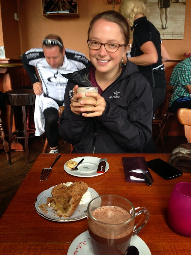
Dark clouds released a 10 minute rainstorm while we changed into our kayaking outfits. Luckily, 5 minutes into the trip the rain stopped and didn't bother us again all day. The first portion of the route goes through the Rottemeren, where the Rotte widens into a gusty lake where sailing is popular. Soon, the river narrowed again. Our motivation level was at a bit of a low, so we landed on the dock at Cafe Oud Verlaat (see photo above) and paused for some hot drinks and typical Dutch apple cake. The cafe was packed with Sunday morning biker groups, who were having the same fare.

So happy to have found coffee and apple cake, 2 miles into our paddle :)
Filled with apple cake energy
Back on the water a half hour later, we were revived and excited to continue on our journey. We passed an artificial ski hill, where people seemed to be skiing and snowboarding (no snow, mind you). At this point the river became more developed, and we had a chance to see into the lives of many canal side families enjoying a relaxed Sunday brunch (no one closes their curtains here). 

Massive canal houses
Can't forget the windmill photo
Crew shells and many large boats sped past us, and we joked about hitching a ride on the way back (well, it was serious until it came down to putting our thumbs out - then my shyness overtook the situation!). We often caught up to the large boats at low bridges, which we zipped under while the larger boats waited for the scheduled bridge openings. 

We paddled until ~1pm, when we looked at the map and realized that downtown Rotterdam and the Kralingse Plas (two potential destinations) were still many kilometers away. Instead, we aimed for the Bergse Voorplas, a lake on the right side of the river. The map showed a narrow blue strip connecting the river to the south end of the lake. To our disappointment (or maybe relief?), the narrow canal was actually a manually-operated lock connecting the high river to the low lake. Instead, we unloaded at a small dock and walked across the levee to the lake with our afternoon veggie snacks. The lake was incredibly windy, so we turned around after a short walk to the marina, where a sailing race was beginning. We watched a small motor boat passing through the lock, which was manually operated by a woman sitting in the adjacent booth. 

Views across the Bergse Voorplas (small lake with many sailboats)
Not too much happened on the return trip, except a gradual draining of our energy levels and increase in wind. We paid for our kayak rentals and made it 0.5 km down the bike path before veering into a lakeside cafe, where we feasted on tomato soup, french fries, croquet (fried gravy stick), and two massive bottles of water, which I promptly poured into my nalgene bottle (much to the server's amusement).

Typical canal scenery
We took a more scenic and slightly longer bike route back to Delft, consisting of mostly independent bike paths (no adjacent street). At ~7pm we arrived home and I promptly fell asleep before I could even taste the delicious deviled eggs that Elizabeth made for dinner. 


Date: Sunday, Sep 21st, 2014
Distance: 12.2 miles (19.6 km) kayaking + 24 miles (39 km) of biking
Duration: 6 hrs kayaking + 2.5 hrs biking (includes 2 cafe stops!)

21 August 2014

Bike Touring on Texel Island

I'm in Delft! This post is not about kayaking...

Bridget spontaneously decided to come visit for 2 weeks after her work cruise in Romania was cancelled. The Netherlands is close to Romania, right? She arrived a day after me and we've been exploring the city of Delft together. Of course, our first inclination was to get out of the city, so we made plans to visit Texel Island, which is one in a string of barrier islands (the Frisian Islands) along the Netherlands, Germany, and Denmark. The map below shows the West Frisian Islands, along the Dutch coast. Texel island is the furthest west, and connects to the mainland (city of Den Helder) by ferry.


From the Delft train station (~1 mile from my apartment), we took two trains to reach Den Helder. From there, we wandered along the levee in Den Helder until we found the ferry terminal (vaarhaven).

The levee/seawall along the coast in Den Helder. No beach left here...
Almost at the ferry terminal
Texel Island is best seen by bike, so we rented bikes next to the ferry terminal when we arrived. We rented the cheap bikes (no gears) for 12 euros/person for 2 days. It took some finagling to attach my backpack to the back of the bike. This was my first overnight bike trip, so it was all new to me. Bridget informed me that this was NOT how bike gear is normally organized. We rode 12 km to Den Koog, which is on the northern coast of the island. On either side we were greeted with picturesque fields of sheep, cows, and horses.

Happy Bridget, moments before her backpack fell off the bike.
Massive backpack strapped to bike.
Baaaaa
The rest of the afternoon was a combination of (covered) patio drinks, window shopping, beach wandering, biking, and admiring the Dutch style of camping (Monster tents with wifi, front porches, fully equipped kitchens, and multiple rooms). We scouted out a lunch spot behind a beach bar which was in a wind shadow, only to have sand dumping on our heads and picnic from above. Mmmmm crunchy cheese. We spent a few hours huddling in the tent during the afternoon thunderstorms, after which we went on a much less gear-laden bike ride to the neighboring Dunes of Texel National Park and watched the sunset from the beach.

One example of a massive Dutch-style encampment
Hiding in our mini tent during one of many afternoon thunderstorms
Sunset walk at the Dunes of Texel National Park

The next morning we woke to a reasonably dry tent and a glint of sunlight. However, by the time we had packed up our bags, the rain was pummeling the tent once again. We conducted the worlds fastest tent take-down and ate our last bread and cheese in the campground bathrooms (less gross than you're imagining). We returned to our bikes and unlocked the super fancy Dutch locks (which lock across the spokes of the back wheel, simply preventing it from rotating. This allows you to leave the bike standing anywhere). On the trip back to the ferry terminal we encountered a massive deluge of rain and hail. After a few minutes of the intensity, we took shelter behind a small shed, huddling next to a French couple. We saw some of our biking acquaintances (other bikers who passed/we passed intermittently) battling the storm and waved from our happy dry spot. Back at the ferry terminal we shared grins of mutual understanding: we survived the storm together.

Huddling behind a shed, hiding from the hail and torrential downpour.

15 December 2013

Bikes and Hikes in Colorado (Jeff's story)

My friend Jeff Buchman (we go way back - to being aspiring kayak bums at BayCreek 10+ years ago!) describes a short weekend in November when I visited Colorado, where he lives. 

[Nena's comments in italics.]

Saturday, November 16th:
Nena arrived in Denver around 10:00 and we immediately headed up to Fort Collins with two bikes on the car for brunch and brewery tours. We decided to have brunch at Snooze, a local chain that specializes in creative and delicious breakfast and lunch foods. Since there was a 20 minute wait and Nena was hungry from her flight we wandered down to the food co-op and got some wasabi peas as an appetizer [I'm going through a meaaan wasabi kick lately]. On the way back to Snooze we also decided that stopping at the candy store would be a good way to balance out the spice of the peas. Once seated we did order actual food with Nena opting for the Late Harvest Benny (Wilted Swiss chard, fennel and leeks served atop goat cheese and herb polenta cakes with poached Niman Ranch eggs, cream cheese hollandaise and toasted pine nut crumb) and I went for the traditional corned beef hash. Breakfast over, we went to Brian and Emily’s house where we met their chickens and fed them from our hands, with mixed results. [It stabbed me!!]

We headed out on the bikes to visit a few of the dozen or so breweries scattered across Fort Collins. The first stop is the best know: New Belgium Brewery. While we were not able to take the tour (reservations have to be made well in advance), we enjoyed the tasting room and tried a wide variety of beers. The two most interesting ones we sampled were the coconut curry beer that tastes more strongly of Indian food than I ever expected and the sour beer, which I actually like but have been told is an acquired taste [grossss]. When we went back to the bikes to head over to the Odell Brewery we discovered that Nena’s bike fell victim to a goat’s head thorn which has flattened at least eight of my bike tires since moving here [bikes always seem to break the first time I ride them... hmm...]. Brian returned home to fetch the car while Nena, Emily, and I walked our bikes the short distance to Odell’s. We sipped beers on the patio until it started to get too chilly. We crammed two bikes and 4 people into Brian's Subaru Forester and headed home for some amazing home-cooked vegetable enchiladas a la Brian and Emily.

Brian, Emily, Nena, and Jeff posing for a cheesy tourist photo :)
Sunday, November 17th:
It was a brisk yet sunny fall day in Boulder when Nena, Brian, Emily, Katrina the dog, and I decided to go climb a mountain and see some snow because we are in Colorado and that’s what you do. The first hike we tackled was Green Mountain West Ridge Trail starting at Flagstaff Road. We weren’t sure we would be able to do this hike since Flagstaff Road was seriously damaged in the massive September floods, but luckily it had opened up the day before. While the hike is relatively short (2.5 miles, round trip), it has a considerable amount of vertical gain and a starting elevation of about 7,000 feet higher than Nena’s typical 0-30 feet above sea level [subtly telling my I'm out of shape.]. The hike starts on a fairly narrow section of trail, meandering along a ridge through pine forests dusted in snow (the ski resorts 1.5 hours west got 17” of snow that day). The climb begins with the trail pitching up sharply for 375 feet in about ¼ of a mile with some small scrambles and roughhewn stairs along the way. The top of Green Mountain was breezy, but protection from the rocks allowed us to sit and admire the view of Colorado’s Front Range [Colorado is so pretty!]. Being an out and back trail, the return to the car was eerily similar but much more down than up. Back at the car, we enjoyed avocado and drunken cheese sandwiches before heading on to the second hike of the day.


Only a few miles down the road, in the Walker Ranch Open Space overlooking Eldorado Canyon, our second hike featured more wind and less climbing. We decided to keep this hike a bit shorter, at 1.7 miles, as the loop trail is 10 miles and the snow/mud mixture made hiking into the creek bed a bit slippery. Katrina, the suburban dog, faced the frequent mountain bikers with curiosity and fear. We were able to see a train slowing climbing Eldorado Canyon to the continental divide about 30 miles to the west. With sunset approaching, and a persistent wind, we decided it was time to head back to Boulder. [Brrrrrr]


Total Distance Hiked: 4.2 miles

- Jeff Buchman